
HOUSTON – Residents across the Houston area woke up to light rain Wednesday morning as a cold front pushed through the region. The system, which has been moving steadily across Texas, is expected to pass completely by early afternoon, bringing noticeable changes in temperature and wind patterns.
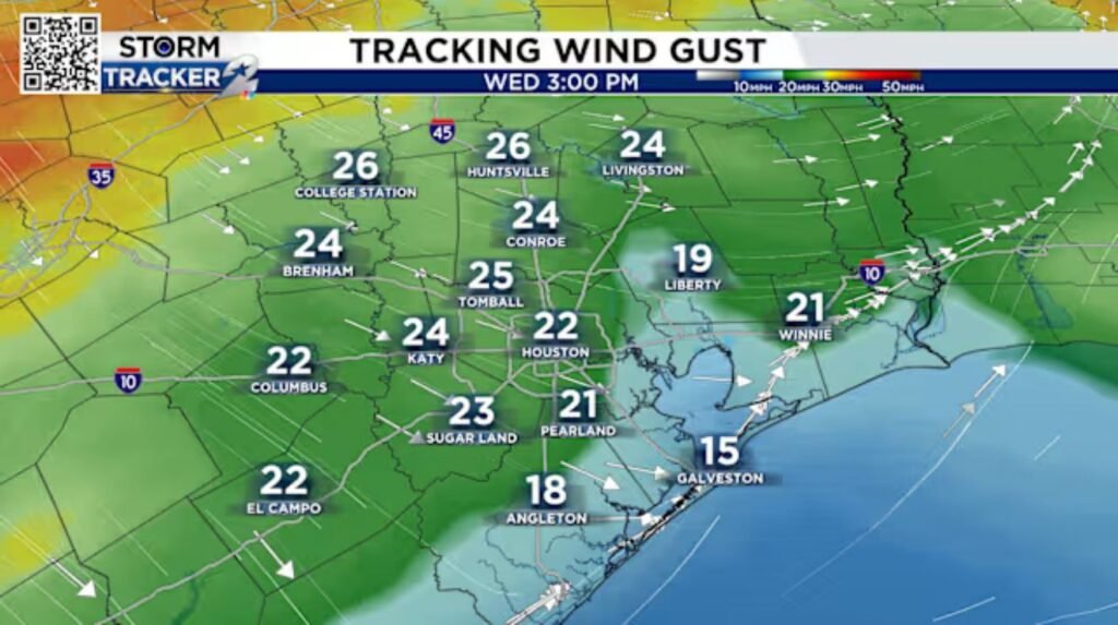
According to meteorologists, winds will shift from a southwesterly direction to northwesterly as the front progresses, maintaining breezy conditions throughout the day. Gusts are forecasted to reach speeds of up to 25 mph, which could make outdoor activities slightly challenging. The strong breeze may also create minor disruptions, particularly for high-profile vehicles on roadways and for those spending extended time outdoors.
The brief rainfall provided some much-needed moisture, though it was not substantial enough to significantly impact drought conditions in some parts of the region. However, the cooler air behind the front is expected to bring relief from recent warm temperatures, offering Houston a taste of refreshing springtime weather.
As the system moves further southeast, forecasters predict drier conditions and gradually clearing skies later in the evening. Temperatures are expected to drop slightly overnight, making for a cooler start to Thursday morning.
Residents are advised to stay updated on any further weather developments, especially as winds remain gusty throughout the day. Drivers should exercise caution on highways, and those with outdoor plans may want to prepare for blustery conditions.
Stay tuned for more updates on Houston’s ever-changing weather.